Sketchup Resources
- SKP for iphone/ipad
- SKP for terrain modeling
- Pool Water In Vray Sketchup
- Rendering Optimization In Vray Sketchup
- Background Modification In sketchup
- Grass Making with sketchup fur plugin
- Landscape designing in
Sketchup - Apply styles with sketchup
- Bedroom Making with sketchup
- Review of Rendering Software
- Enhancing rendering for 3d modeling
- The combination of sketchup &
BIM - Exterior Night Scene rendering with vray
Author :
BLOG

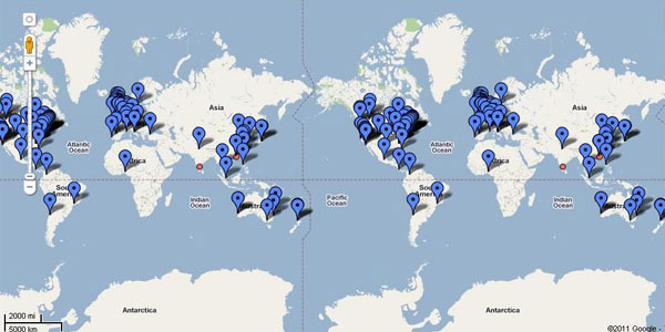
As the world is fast changing, the paradigm of professional learning is also changing. And architectural designing is not an exceptional. That’s why Google has started Authorized Training Centers all over the world. Though there are many online tutorials available on SketchUp, the users find difficulty while using the SketchUp professionally. That’s why Google Authorized Training Center is here to provide the proper knowledge on professional usage of SketchUp. It is very important to have a proper course to methodically learn SketchUp. For that reason Google introduced different courses according to the requirements and proficiency of the users. From a beginner to an advance, Google ATC for SketchUp has all types of course suites for each genre of the learners.
The courses are:
- GOOGLE SKETCHUP ESSENTIALS 1
- GOOGLE SKETCHUP ESSENTIALS 2
- GOOGLE SKETCHUP PRO ADVANCED LANDSCAPE
- GOOGLE SKETCHUP PRO ADVANCED SKILLS
- GOOGLE EARTH PRO ESSENTIALS
Here we can have a small discussion on the each course Google ATC offered:
GOOGLE SKETCHUP ESSENTIALS 1: Google SketchUp Essentials 1 is the starting point of the SketchUp learning. This course contains some basic knowledge of SketchUp. This course is recommended for the new users and for those who have little experience in drawing and wanting to learn three dimensional modeling. The person who has control of mouse of the WINDOWS and MAC OS X along with some basic knowledge can have the eligibility of grabbing the course.
After completion of the course the users will have the understanding on how to use the tools for creating and manipulating 3D forms, create and apply surfaces to a model; import components from Google Warehouse, position and export SketchUp models to Google Earth.
GOOGLE SKETCHUP ESSENTIALS 2: Google SketchUp Essentials 2 is designed for those who has some basic knowledge on SketchUp and Google Earth and especially for those who wish to deepen 3D modeling to discover the full potential of Google SketchUp. The people who have completed the One Earth essentials or master the basics of this software like the environment and interface of SketchUp – modeling objects in two or three dimensions – Navigation and visualization of 3D models.
After completion of this course, the users will be able to use SketchUpto manage the 3D geometry by creating and manipulating groups and components; import information into SketchUp from Google earth, use Photomatch to add photographs to the models; create, edit, apply and mix styles; create a basic presentation.
GOOGLE SKETCHUP PRO ADVANCED LANDSCAPE: Google SketchUp Pro Advanced Landscape is a discipline that encompasses many workflows that result in designs ranging from human scale site fixture to regional master plans. While many of the designins of this course can be created from scratch, often AutoCAD files, surveyor data, hand renderings and existing photography are all incorporated in the design process as well as the end result. Expressing all this information in three dimensions will greatly facilitate communication of the design to the others. After completing the Essential 1 & 2, anyone can opt for this course.
After completion of the course the users will be able to create 2D geometry in 3D environment, create and manipulate 3D faces, maintain a coplanar geometry and use of interface, apply material, use image in the model, add location geo location from Google Earth and many more things.
GOOGLE EARTH PRO ESSENTIALS: Google Earth Pro Essential enables you to compile and present information in a virtual 3D space. In addition, the users will be able to add, view and analyze their own information from a variety of GIS sources along with the background information hosted on Google earth server.
At the completion of this course, you’ll be able to use Google Earth Pro to create and manipulate points, routes and polygons; import and locate addre3ss; import images; export a geo referenced SketchUp model to Google Earth; import ESRI Shape files to create thematic maps; and create basic animations. This course will also allow participants to use techniques to optimize for Google Earth SketchUp models.


