|
Welcome to the space of SketchUp. Our readers will love to hear about you.
Thanks for the opportunity to share my SketchUp experience with your readers.
You have come in to the world of geo modeling without a degree of architects. How do you come so far?
Yes, it is true that I have no education or training in architecture, drafting, or precision drawing of any kind. I suppose I have come as far as I have due to two factors - nearly unlimited patience for attention to detail, and a need to find a meaningful post-retirement pursuit.
Why do you prefer to design in SketchUp?
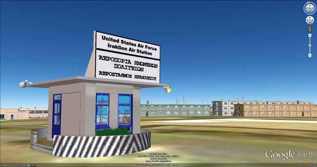
I must admit that I have little basis for comparison since SketchUp was my first and only foray into architectural drawing. I will say that it is unlikely that I would have ever taken this turn in my life had SketchUp not been so effortless and compelling to learn. I have always learned best by doing. I had a desire to reproduce my old US Air Force base on the island of Crete. SketchUp and Google Earth provided the means to do that.
What was your reaction when you got the recognition from Google? Please share with us your feeling of that moment.
I had been hearing positive things about Google for several years. Google seemed to be a corporation that catered to both its users and its employees. I was fascinated with Google Earth when I learned of it several years ago, and after retirement I began to explore Google Earth even more. Once I began my project to reproduce Iraklion Air Station I had a need to contact one of the Google 3D Warehouse representatives with a question. I was expecting some sort of generic corporate response. Instead, I received a very helpful and encouraging response from Allison,one of the Google Guides. I had many occasions to correspond with her and other Google representatives whom I found to be very helpful and encouraging in my Geo-modeling pursuits. After I had established myself as a consistent 3D Warehouse contributor I was offered the opportunity to become a Google-certified 3D Geo-modeler by entering their qualifying program and passing an exam and other requirements. In 2010 I passed the exam and completed the requirements to become one of a small group of 3D Geo-modelers certified by Google. I have been very proud to be certified by Google, and to have been encouraged by them to continue my pursuit of creating Google Earth geo-models. That is why I am now so devastated that hand-made geo-models will be coming to a close, to be replaced by automated 3D images. It is sad to see this ending for myself and many other dedicated geo-modelers who have spent countless hours contributing their meticulously built models to Google Earth.
You have proved the SketchUp is really made for all. What is your opinion on that?
I began to learn SketchUp around 2007 after I retired from a career of counseling juvenile offenders. I had never used any kind of architectural software before, nor did I have any kind of training or experience in precision drawing. Therefore, if a man in his mid-60's can learn this software in a short period of time just by watching a few available videos, then anyone can. It is truly an amazingly quick program to learn with very useful results.
According to you what is the importance of geo modeling to a general people?
Until about June 6, 2012 I believed that hand-crafted geo-models were the wave of the future and that businesses and corporations would more and more recognize the value of a well-crafted geo model of their business prominently displayed on Google Earth. However, unless Google finds a way for them to be included, all hand-crafted geo-models will be replaced by Google's mass-modeled 3D structures. While competitive technology demands that Google takes this step it is regretful that such carefully crafted geo-models must be replaced.
What was your first 3D modeling?
As I mentioned earlier, my very first 3D model was of the operations building at the now decommissioned Iraklion Air Station, Crete, where I was stationed in 1965. This model came about after I reconnected with an old Air Force buddy, and we began to try to recall the layout of the base. When we discovered the flattened images on Google Earth and I found SketchUp I began to amass hundreds of old photos of the base and reconstructed nearly the entire small base in digital 3D models. Using these 3D models and Google Earth I produced a nostalgic video of life at Iraklion Air Station which has been viewed by thousands of veterans of the old base: http://www.youtube.com/watch?v=8eSp-qTamwE&feature=g-upl
What is your favorite city/building in 3D? Which is the city/building you enjoyed most to do 3D modeling?
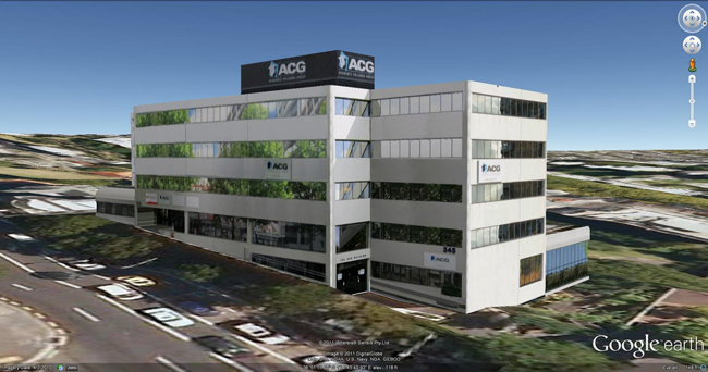
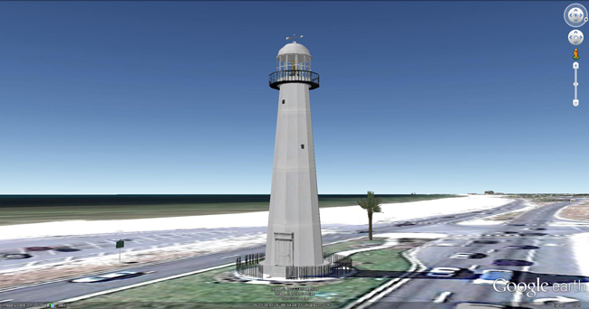
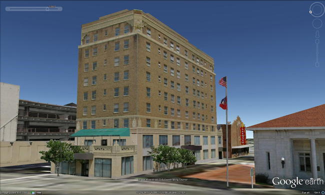
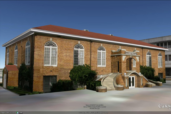
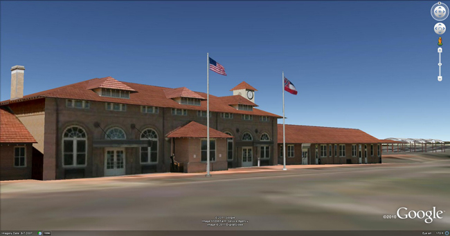
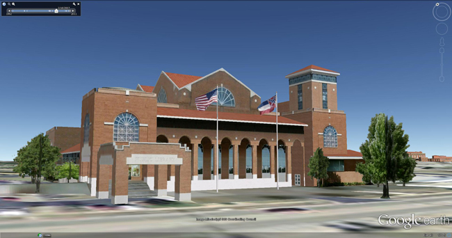
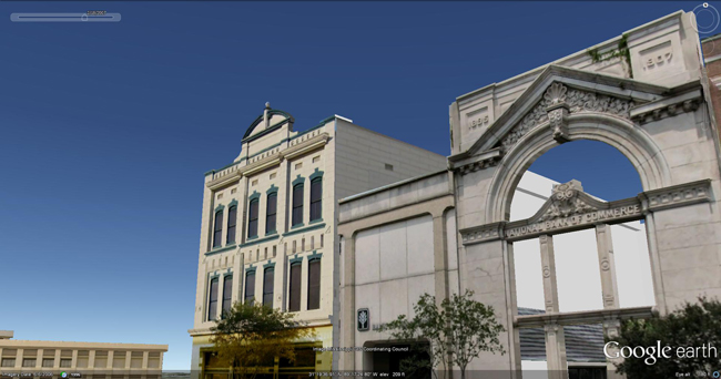
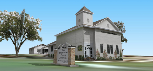
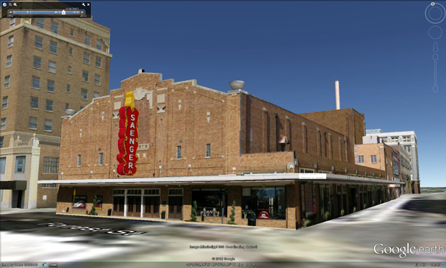
Well, of course, my favorite city in 3D is Historic Downtown Hattiesburg, Mississippi. After I completed the Air Force Base I turned my attention to my home area. Downtown Hattiesburg is in the process of revitalization. Many historic buildings have been restored, and the downtown area is becoming vibrant once again. I wanted to contribute to that effort by preserving the historic architecture in digital 3D on Google Earth. So far I have completed models of 34 structures which can be viewed at http://sketchup.google.com/3dwarehouse/cldetails?mid=e15bb0e1efd32f293fb26e3eef2f878d . A virtual tour video of downtown Hattiesburg can be viewed at http://www.youtube.com/watch?v=nFpw2-B0hdE&feature=g-upl . Sadly, unless Google can find a way to preserve hand-made models I don't think I have the heart to continue this project, knowing that one day all the hand-crafted models will be replaced by the automated models.
And which one was most challenging so far?
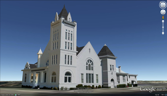
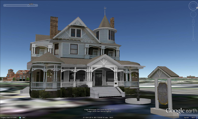
Probably the most challenging, yet the most satisfying model was the Queen Anne Victorian-styled McLeod house in Downtown Hattiesburg. The irregular and intricate historic architecture required some very meticulous and time-consuming modeling, measuring, estimating, and photographing to complete, but the end result was worth the effort. It can be viewed at the warehouse: http://sketchup.google.com/3dwarehouse/details?mid=be4454db0f9cd5d83fb26e3eef2f878d or a brief virtual tour video: http://www.youtube.com/watch?v=tKvqB6jzcSk&feature=g-upl .
If you will be given an option to make 3D model of a city of your choice then which city it will be?
My wish would be to see the completion of the modeling of Historic Downtown Hattiesburg and the preservation of those hand-made models on Google Earth. Otherwise, it is a moot point since Google will be doing cities en masse in the future.
Who or what is your inspiration of doing the 3D modeling on Google Earth?
Since geo modeling is a relatively recent phenomenon I don't really have a mentor. However, I have become aware of a number of fellow geo modelers whose work I admire and envy. Among those that I am aware of are: Beryl Reid, Kent Morrison, Chris Mowat, Jorge De Albertis Bettocchi, Tang Huang, Ghaleb Fawzi, Nestor Suarez, and many, many other fine geo modelers.
Please give some tips to the budding Google SketchUp modeler.
With the ardent hope that Google will find a way to retain the finely crafted models of the geo modeler in the future I would encourage any hopeful SketchUp modeler to download the free software, watch the many available SketchUp tutorials on YouTube, and then find an inspirational project to lose themselves in. My theory is that the best learning comes from pursuing something real that you want to do. You will find the way if you want it.
What is your advice to the team of Sketchup ur Space?
I don't know that I am in a position to advise the SKetchUp ur Space team, but I would hope that through your publication Google will be encouraged to create a way for finely hand-crafted geo models to remain on Google Earth. I appreciate and enjoy your publication and the opportunity to pass on my brief SketchUp Saga to your readers.
|


